Geolocate

Trogir topographic map

Click on the map to display elevation.

About this map

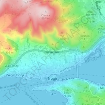
Name: Trogir topographic map, elevation, terrain.

Location: Trogir, Grad Trogir, Split-Dalmatia County, 21219, Croatia (43.50465 16.23418 43.55101 16.28367)

Average elevation: 124 m

Minimum elevation: -4 m

Maximum elevation: 449 m

Gear up for your next adventure:

🛶Kayak Dry Bag - Waterproof storage for kayaking adventures
🧼Travel Hand Sanitizer - Keep hands clean when water is scarce
🚲Heavy Duty Bike Lock - Secure your bike at the trailhead or during stops
🔋Solar Power Bank - Keep your GPS and devices charged during long outdoor trips
🧢Hiking Sun Hat - Wide-brimmed protection for exposed mountain ridges

As an Amazon Associate, this site earns from qualifying purchases at no extra cost to you.