Geolocate

Retinella topographic map

Click on the map to display elevation.

About this map

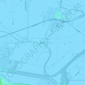
Name: Retinella topographic map, elevation, terrain.

Location: Retinella, Loreo, Rovigo, Veneto, 45017, Italy (45.02931 12.15798 45.06931 12.19798)

Average elevation: -2 m

Minimum elevation: -7 m

Maximum elevation: 8 m

Gear up for your next adventure:

🧰Multitool Knife - Compact and versatile tool for outdoor use
🧢Outdoor Cap - Protective cap for sun and rain during hikes
Lightweight Camping Tent - Portable shelter optimized for Canadian backcountry camping
🧰Emergency Multi-Tool - Compact multi-tool for outdoor survival
🥾Trail Hiking Shoes - Durable shoes designed for rugged trails

As an Amazon Associate, this site earns from qualifying purchases at no extra cost to you.