Geolocate

Kyotamba topographic map

Click on the map to display elevation.

About this map

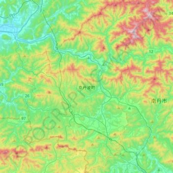
Name: Kyotamba topographic map, elevation, terrain.

Location: Kyotamba, Funai County, Kyoto Prefecture, 622-0315, Japan (35.09688 135.27838 35.34854 135.50258)

Average elevation: 297 m

Minimum elevation: 30 m

Maximum elevation: 898 m

Gear up for your next adventure:

💡LED Headlamp - Hands-free illumination for night hiking and camping
🛏️Sleeping Bag - Warm and compact sleeping bags for outdoor camping
🛶Waterproof Dry Bags - Keep electronics and clothes dry during river crossings
🥾Mountain Hiking Shoes - Shoes with superior grip for mountainous terrain
🧊Portable Cooler - Keep food and drinks cold during outdoor adventures

As an Amazon Associate, this site earns from qualifying purchases at no extra cost to you.