
Chakrata topographic map
Click on the map to display elevation.
Chakrata
It lies between the Tons and Yamuna rivers, at an elevation of 2118 m, 98 km from the state capital, Dehradun. Chakrata was originally a cantonment of the British Indian Army. To the west lies Shillai, Himachal Pradesh, and to the east are Mussoorie (73 km) and Tehri Garhwal.
About this map
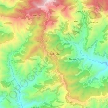
Name: Chakrata topographic map, elevation, terrain.
Location: Chakrata, Dehradun, Uttarakhand, 248123, India (30.66132 77.83034 30.74132 77.91034)
Average elevation: 1,851 m
Minimum elevation: 1,220 m
Maximum elevation: 2,780 m