Geolocate

Qantir topographic map

Click on the map to display elevation.

About this map

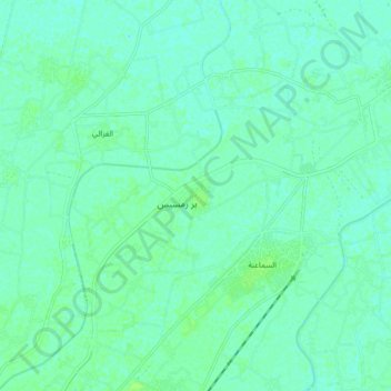
Name: Qantir topographic map, elevation, terrain.

Location: Qantir, Sharqia Governorate, 44679, Egypt (30.76328 31.79842 30.84328 31.87842)

Average elevation: 5 m

Minimum elevation: 1 m

Maximum elevation: 9 m

Other topographic maps

Click on a map to view its topography, its elevation and its terrain.

10th of Ramadan

Egypt > Sharqia Governorate

Average elevation: 104 m

Abou Kebir City

Egypt > Sharqia Governorate

Average elevation: 7 m

Gear up for your next adventure:

💧Filtered Water Bottle - Safe drinking water on the go
💡Portable Camping Lamp - Rechargeable lamp for campsite lighting
🔨Vehicle Emergency Tool - Safety tool for remote road trips to trailheads
🧥Packable Rain Jacket - Breathable waterproof layer for unpredictable weather
🩹Moleskin Blister Pads - Direct protection for painful foot pressure points

As an Amazon Associate, this site earns from qualifying purchases at no extra cost to you.