Geolocate

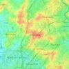
Fourmies topographic map

Click on the map to display elevation.

About this map

Name: Fourmies topographic map, elevation, terrain.

Location: Fourmies, Avesnes-sur-Helpe, Nord, Hauts-de-France, Metropolitan France, 59610, France (49.97978 4.02101 50.03298 4.09793)

Average elevation: 214 m

Minimum elevation: 170 m

Maximum elevation: 247 m

Other topographic maps

Click on a map to view its topography, its elevation and its terrain.
Arenberg

France > Hauts-de-France > Nord > Wallers

Average elevation: 31 m

Mouvaux

France > Hauts-de-France > Nord > Mouvaux > Mouvaux

Average elevation: 35 m

Gear up for your next adventure:

🩹Compact First Aid Kit - Pre-packed essentials for common trail injuries
🍽️Titanium Camping Spork - Ultralight and indestructible eating utensil
🧥Waterproof Pants - Keep dry during rainy hiking conditions
🔭Compact Monocular - One-handed bird watching and trail spotting
🔭Outdoor Binoculars - Lightweight binoculars for birdwatching and hiking

As an Amazon Associate, this site earns from qualifying purchases at no extra cost to you.