Geolocate

Montería topographic map

Click on the map to display elevation.

About this map

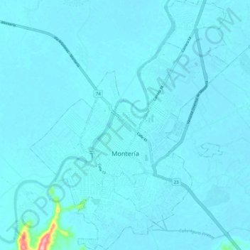
Name: Montería topographic map, elevation, terrain.

Location: Montería, Centro, Córdoba, RAP Caribe, Colombia (8.71273 -75.91712 8.81173 -75.83712)

Average elevation: 15 m

Minimum elevation: 8 m

Maximum elevation: 164 m

Other topographic maps

Click on a map to view its topography, its elevation and its terrain.

Planeta Rica

Colombia > Córdoba > Planeta Rica

Average elevation: 77 m

Sitio Nuevo

Colombia > Córdoba > Lorica

Average elevation: 4 m

Baru

Colombia > Córdoba > Tierralta

Average elevation: 38 m

SEVERA

Colombia > Córdoba > Cereté > Corregimiento Severa

Average elevation: 12 m

Montería

Colombia > Córdoba > Montería

Average elevation: 25 m

Tres Piedras

Colombia > Córdoba

Average elevation: 30 m

Gear up for your next adventure:

🧥Waterproof Hiking Jacket - Protect yourself from rain and wind while hiking
🔦LED Headtorch - Bright and durable light for night activities
🧥Thermal Layer - Insulating layer for cold outdoor conditions
🥾Hiking Gaiters - Protect legs and shoes from mud, snow, and debris
🐕Hiking Dog Pack - Let your canine companion carry their own water and food

As an Amazon Associate, this site earns from qualifying purchases at no extra cost to you.