Geolocate

Camagong topographic map

Click on the map to display elevation.

About this map

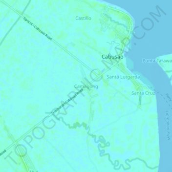
Name: Camagong topographic map, elevation, terrain.

Location: Camagong, Cabusao, Camarines Sur, Bicol Region, Philippines (13.70042 123.08637 13.74042 123.12637)

Average elevation: 2 m

Minimum elevation: -3 m

Maximum elevation: 5 m

Gear up for your next adventure:

📷Outdoor Action Camera - Capture high-elevation views and rugged adventures
🛏️Camping Sleeping Mat - Comfortable mats for sleeping outdoors
Backpacking Tent - Lightweight tent for long-distance hiking trips
🔦LED Headlamp - Hands-free lighting for early morning starts or late finishes
🔭Compact Monocular - One-handed bird watching and trail spotting

As an Amazon Associate, this site earns from qualifying purchases at no extra cost to you.