Geolocate

By Pass topographic map

Click on the map to display elevation.

About this map

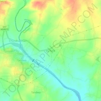
Name: By Pass topographic map, elevation, terrain.

Location: By Pass, Keredari, Hazaribagh, Jharkhand, 825321, India (23.83862 85.02380 23.87862 85.06380)

Average elevation: 452 m

Minimum elevation: 430 m

Maximum elevation: 480 m

Gear up for your next adventure:

Bushcraft Tarp - Versatile emergency shelter or gear protection
🧢Outdoor Visor - Breathable visor for sunny hikes
🦌Outdoor Trail Camera - Monitor wildlife activity near your favorite spots
🔭Compact Monocular - One-handed bird watching and trail spotting
🚲Handlebar Phone Mount - View topographic-map.com live while cycling

As an Amazon Associate, this site earns from qualifying purchases at no extra cost to you.