
Thank you for supporting this site ❤️
Make a donation
Make a donation
Gear up for your next adventure:
As an Amazon Associate, this site earns from qualifying purchases at no extra cost to you.
Chianchiro topographic map
Click on the map to display elevation.
Thank you for supporting this site ❤️
Make a donation
Make a donation
Gear up for your next adventure:
As an Amazon Associate, this site earns from qualifying purchases at no extra cost to you.
About this map
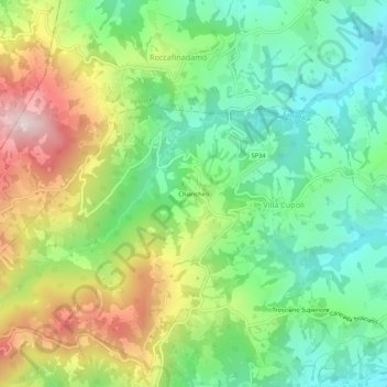
Name: Chianchiro topographic map, elevation, terrain.
Location: Chianchiro, Villa Cupoli, Farindola, Pescara, Abruzzo, Italy (42.44485 13.80780 42.48485 13.84780)
Average elevation: 511 m
Minimum elevation: 284 m
Maximum elevation: 892 m
Thank you for supporting this site ❤️
Make a donation
Make a donation
Gear up for your next adventure:
As an Amazon Associate, this site earns from qualifying purchases at no extra cost to you.