Geolocate

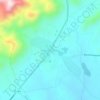
Canadá topographic map

Click on the map to display elevation.

About this map

Name: Canadá topographic map, elevation, terrain.

Location: Canadá, Redenção, Região Geográfica Imediata de Redenção-Acarape, Região Geográfica Intermediária de Fortaleza, Ceará, Região Nordeste, Brasil (-4.19455 -38.84285 -4.18125 -38.82893)

Average elevation: 371 m

Minimum elevation: 223 m

Maximum elevation: 635 m

Other topographic maps

Click on a map to view its topography, its elevation and its terrain.
Antônio Diogo

Brasil > Ceará > Redenção

Average elevation: 224 m

Barra Nova

Brasil > Ceará > Redenção > São Gerardo

Average elevation: 278 m

Gear up for your next adventure:

🥾Durable Hiking Shoes - Long-lasting shoes for frequent hiking
🧰Survival Kit - Essential gear for emergencies in the wilderness
🥾Trekking Poles - Adjustable trekking poles to reduce knee stress and improve stability
🧴Outdoor Sunscreen - High SPF protection for high-altitude UV exposure
🕯️Camping Lantern - Illuminates your entire campsite with high-efficiency LEDs

As an Amazon Associate, this site earns from qualifying purchases at no extra cost to you.