Geolocate

Mazunte topographic map

Click on the map to display elevation.

About this map

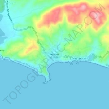
Name: Mazunte topographic map, elevation, terrain.

Location: Mazunte, Santa María Tonameca, Oaxaca, 70949, Mexico (15.64759 -96.57366 15.68759 -96.53366)

Average elevation: 42 m

Minimum elevation: 0 m

Maximum elevation: 189 m

Gear up for your next adventure:

🦯Trekking Poles - Reduced impact on joints for steep topographic climbs
💧Hydration Pack - Hands-free hydration system for long hikes
🐕Hiking Dog Pack - Let your canine companion carry their own water and food
🥾Lightweight Hiking Shoes - Comfortable shoes for day hikes
🧴Outdoor Sunscreen - High SPF protection for high-altitude UV exposure

As an Amazon Associate, this site earns from qualifying purchases at no extra cost to you.