Geolocate

Dela Paz topographic map

Click on the map to display elevation.

About this map
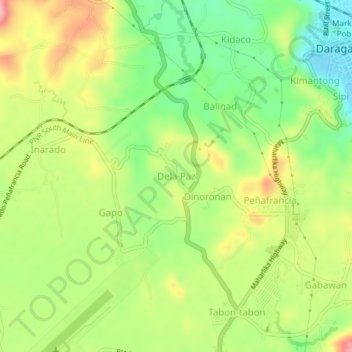
Name: Dela Paz topographic map, elevation, terrain.

Location: Dela Paz, Daraga, Albay, Bicol Region, 4501, Philippines (13.11341 123.67360 13.15341 123.71360)

Average elevation: 89 m

Minimum elevation: 23 m

Maximum elevation: 168 m

Other topographic maps

Click on a map to view its topography, its elevation and its terrain.

Yawa River

Philippines > Albay > Daraga > Busay

Average elevation: 47 m

Cagsawa Ruins Park

Philippines > Albay > Daraga > Busay

Average elevation: 68 m

Gear up for your next adventure:

🧴Outdoor Sunscreen - High SPF protection for high-altitude UV exposure
⛺Camping Groundsheet - Protect your tent from moisture and dirt
🧴Insect Repellent - Protect yourself from bugs during outdoor adventures
🧴Bear Spray Holster - Quick-access carry for essential Canadian wilderness safety
🛌Insulated Sleeping Pad - Critical thermal barrier between you and the cold ground

As an Amazon Associate, this site earns from qualifying purchases at no extra cost to you.