
Schnellingen topographic map
Click on the map to display elevation.
About this map
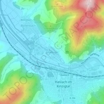
Name: Schnellingen topographic map, elevation, terrain.
Average elevation: 293 m
Minimum elevation: 204 m
Maximum elevation: 574 m
Other topographic maps
Click on a map to view its topography, its elevation and its terrain.
Haslach
Deutschland > Baden-Württemberg > Ortenaukreis > Haslach im Kinzigtal
Average elevation: 330 m
Haslach
Deutschland > Baden-Württemberg > Ortenaukreis > Haslach im Kinzigtal
Average elevation: 330 m