Geolocate

Franklin topographic map

Click on the map to display elevation.

About this map

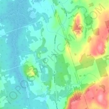
Name: Franklin topographic map, elevation, terrain.

Location: Franklin, Kawartha Lakes, Central Ontario, Ontario, Canada (44.21274 -78.60384 44.25274 -78.56384)

Average elevation: 283 m

Minimum elevation: 246 m

Maximum elevation: 369 m

Ontario trails, hiking, mountain biking, running and outdoor activities

Other topographic maps

Click on a map to view its topography, its elevation and its terrain.

Victoria Lake

Canada > Ontario > Kawartha Lakes

Average elevation: 308 m

Cameron Lake

Canada > Ontario > Kawartha Lakes > Fenelon Falls

Average elevation: 262 m

Four Mile Lake

Canada > Ontario > Kawartha Lakes

Average elevation: 282 m

Sturgeon Lake

Canada > Ontario > Kawartha Lakes

Average elevation: 266 m

Dalrymple Lake

Canada > Ontario > Kawartha Lakes

Average elevation: 241 m

Pigeon River

Canada > Ontario > Kawartha Lakes > Omemee

Average elevation: 259 m

Young Lake

Canada > Ontario > Kawartha Lakes

Average elevation: 231 m

Head Lake

Canada > Ontario > Kawartha Lakes

Average elevation: 278 m

Emily Provincial Park

Canada > Ontario > Kawartha Lakes

Average elevation: 259 m

Gear up for your next adventure:

🚲MTB Frame Bag - Carry tools and maps directly on your bicycle frame
Tent Footprint - Protect tent floor and increase durability
💧Filtered Water Bottle - Safe drinking water on the go
🧴Waterproofing Spray - Restore the DWR coating on jackets and tents
🧊Portable Cooler - Keep food and drinks cold during outdoor adventures

As an Amazon Associate, this site earns from qualifying purchases at no extra cost to you.