Geolocate

Calantas topographic map

Click on the map to display elevation.

About this map

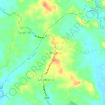
Name: Calantas topographic map, elevation, terrain.

Location: Calantas, Macalelon, Quezon, Calabarzon, 4309, Philippines (13.76466 122.11947 13.80466 122.15947)

Average elevation: 21 m

Minimum elevation: 1 m

Maximum elevation: 57 m

Gear up for your next adventure:

🥾All-Terrain Hiking Boots - Versatile boots for varied hiking conditions
🎒Hiking Backpack - Lightweight and ergonomic backpacks for day hikes or multi-day treks
🧥Thermal Layer - Insulating layer for cold outdoor conditions
Lightweight Backpacking Tent - Compact tent for efficient hiking trips
🎒Hiking Daypack - Lightweight and durable backpacks for day trips and excursions

As an Amazon Associate, this site earns from qualifying purchases at no extra cost to you.