
Richmond topographic map
Click on the map to display elevation.
About this map
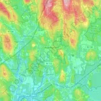
Name: Richmond topographic map, elevation, terrain.
Location: Richmond, South County, Rhode Island, United States (41.42835 -71.72231 41.56306 -71.59667)
Average elevation: 56 m
Minimum elevation: 12 m
Maximum elevation: 159 m
Other topographic maps
Click on a map to view its topography, its elevation and its terrain.
West Kingston
United States > Rhode Island > South County > South Kingstown > West Kingston
Average elevation: 41 m