
Thank you for supporting this site ❤️
Make a donation
Make a donation
Gear up for your next adventure:
As an Amazon Associate, this site earns from qualifying purchases at no extra cost to you.
Panicagliora topographic map
Click on the map to display elevation.
Thank you for supporting this site ❤️
Make a donation
Make a donation
Gear up for your next adventure:
As an Amazon Associate, this site earns from qualifying purchases at no extra cost to you.
About this map
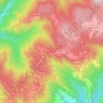
Name: Panicagliora topographic map, elevation, terrain.
Location: Panicagliora, Marliana, Pistoia, Toscana, Italia (43.93858 10.74582 43.97858 10.78582)
Average elevation: 667 m
Minimum elevation: 273 m
Maximum elevation: 926 m
Thank you for supporting this site ❤️
Make a donation
Make a donation
Gear up for your next adventure:
As an Amazon Associate, this site earns from qualifying purchases at no extra cost to you.