
Weiße Ahe topographic map
Interactive map
Click on the map to display elevation.
About this map
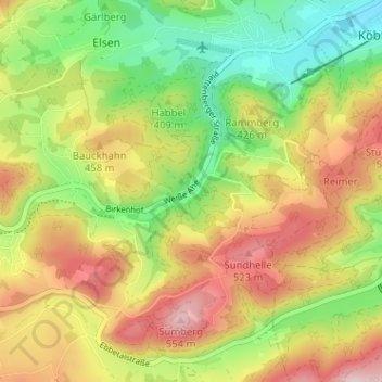
Name: Weiße Ahe topographic map, elevation, terrain.
Average elevation: 405 m
Minimum elevation: 268 m
Maximum elevation: 559 m
Other topographic maps
Click on a map to view its topography, its elevation and its terrain.
Rärin
Deutschland > Nordrhein-Westfalen > Märkischer Kreis > Herscheid
Rärin, Herscheid, Märkischer Kreis, Nordrhein-Westfalen, 58849, Deutschland
Average elevation: 406 m