
Padma River topographic map
Interactive map
Click on the map to display elevation.
About this map
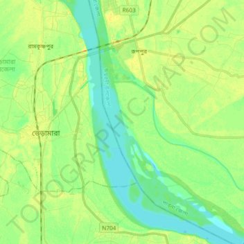
Name: Padma River topographic map, elevation, terrain.
Average elevation: 13 m
Minimum elevation: 1 m
Maximum elevation: 29 m
Other topographic maps
Click on a map to view its topography, its elevation and its terrain.
Joypurhat
Bangladesh > Rajshahi Division > Joypurhat
Joypurhat, Joypurhat District, Rajshahi Division, 5900, Bangladesh
Average elevation: 21 m
Bera
Bangladesh > Rajshahi Division > Bera
Bera, Pabna district, Rajshahi Division, 6688, Bangladesh
Average elevation: 9 m