
Altmar topographic map
Click on the map to display elevation.
About this map
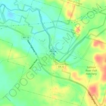
Name: Altmar topographic map, elevation, terrain.
Average elevation: 175 m
Minimum elevation: 152 m
Maximum elevation: 209 m
Other topographic maps
Click on a map to view its topography, its elevation and its terrain.
Tug Hill
United States > New York > Oswego County
The core Tug Hill region encompasses 150,000 acres (610 km2) of unbroken, generally second-growth, northern hardwood forest, and is drained by a vast network of streams. Important rivers and streams whose headwaters are located within the Tug Hill region include the Mohawk River, Deer River, Salmon River, Mad…
Average elevation: 109 m
Constantia Center
United States > New York > Oswego County > Town of Constantia
Average elevation: 169 m
Tug Hill
United States > New York > Oswego County
The core Tug Hill region encompasses 150,000 acres (610 km2) of unbroken, generally second-growth, northern hardwood forest, and is drained by a vast network of streams. Important rivers and streams whose headwaters are located within the Tug Hill region include the Mohawk River, Deer River, Salmon River, Mad…
Average elevation: 109 m