Geolocate

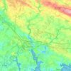
Kerdeliau topographic map

Click on the map to display elevation.

About this map

Name: Kerdeliau topographic map, elevation, terrain.

Location: Kerdeliau, Sainte-Anne-d'Auray, Lorient, Morbihan, Bretagne, France métropolitaine, 56400, France (47.67603 -2.97634 47.71603 -2.93634)

Average elevation: 43 m

Minimum elevation: -4 m

Maximum elevation: 60 m

Other topographic maps

Click on a map to view its topography, its elevation and its terrain.
56400

France > Bretagne > Morbihan > Sainte-Anne-d'Auray > Malachap

Average elevation: 39 m

Gear up for your next adventure:

🥾Lightweight Hiking Shoes - Comfortable shoes for day hikes
🥾Hiking Shorts - Breathable shorts suitable for summer hikes
🧤Rechargeable Heated Gloves - Extreme warmth for Canadian winter expeditions
⛺Backpacking Tent - Lightweight tent for long-distance hiking trips
🧣Merino Neck Gaiter - Protects against wind, sun, and cold at high altitudes

As an Amazon Associate, this site earns from qualifying purchases at no extra cost to you.