
Thank you for supporting this site ❤️
Make a donation
Make a donation
Gear up for your next adventure:
As an Amazon Associate, this site earns from qualifying purchases at no extra cost to you.
Shaftsbury topographic map
Click on the map to display elevation.
Thank you for supporting this site ❤️
Make a donation
Make a donation
Gear up for your next adventure:
As an Amazon Associate, this site earns from qualifying purchases at no extra cost to you.
About this map
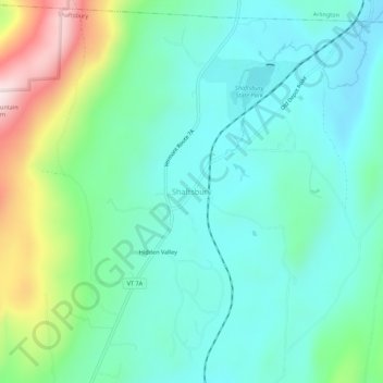
Name: Shaftsbury topographic map, elevation, terrain.
Location: Shaftsbury, Bennington County, Vermont, 05262, United States (42.98892 -73.21169 43.02892 -73.17169)
Average elevation: 355 m
Minimum elevation: 231 m
Maximum elevation: 727 m
Thank you for supporting this site ❤️
Make a donation
Make a donation
Gear up for your next adventure:
As an Amazon Associate, this site earns from qualifying purchases at no extra cost to you.