
Thank you for supporting this site ❤️
Make a donation
Make a donation
Gear up for your next adventure:
As an Amazon Associate, this site earns from qualifying purchases at no extra cost to you.
Schönwalde-Glien topographic map
Click on the map to display elevation.
Thank you for supporting this site ❤️
Make a donation
Make a donation
Gear up for your next adventure:
As an Amazon Associate, this site earns from qualifying purchases at no extra cost to you.
About this map
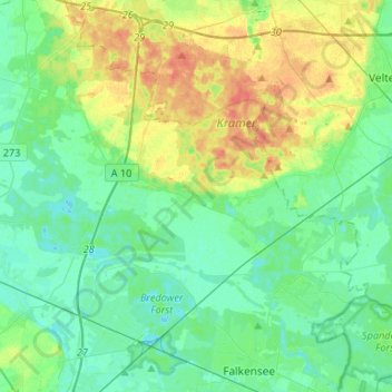
Name: Schönwalde-Glien topographic map, elevation, terrain.
Location: Schönwalde-Glien, Havelland, Brandenburg, 14621, Germany (52.58691 12.90125 52.69252 13.16599)
Average elevation: 39 m
Minimum elevation: 27 m
Maximum elevation: 65 m
Thank you for supporting this site ❤️
Make a donation
Make a donation
Gear up for your next adventure:
As an Amazon Associate, this site earns from qualifying purchases at no extra cost to you.