
Danville topographic map
Click on the map to display elevation.
About this map
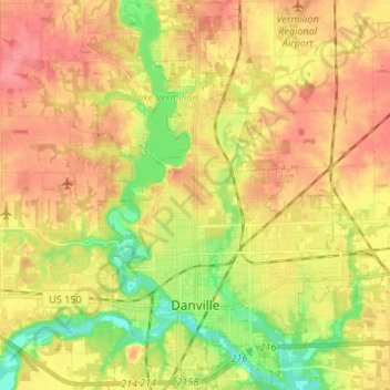
Name: Danville topographic map, elevation, terrain.
Location: Danville, Vermilion County, Illinois, United States (40.10350 -87.66522 40.20450 -87.53170)
Average elevation: 197 m
Minimum elevation: 159 m
Maximum elevation: 227 m
Other topographic maps
Click on a map to view its topography, its elevation and its terrain.
Middle Fork State Fish and Wildlife Area
United States > Illinois > Vermilion County
Average elevation: 206 m