Geolocate

Scottland topographic map

Click on the map to display elevation.

About this map

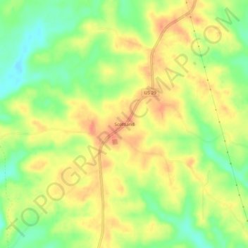
Name: Scottland topographic map, elevation, terrain.

Location: Scottland, Bullock County, Alabama, 36059, United States (32.00654 -85.72634 32.04654 -85.68634)

Average elevation: 150 m

Minimum elevation: 123 m

Maximum elevation: 172 m

Other topographic maps

Click on a map to view its topography, its elevation and its terrain.

Union Springs

United States > Alabama > Bullock County

Average elevation: 139 m

Gear up for your next adventure:

💧Collapsible Water Bottle - Space-saving water bottle for outdoor activities
💡LED Camping Lantern - Illuminate your campsite with long-lasting lanterns
🎒Backpack Rain Cover - External shield to keep your entire pack dry
🕶️Polarized Sunglasses - Reduces glare from snow and water at high elevations
Tent Footprint - Protect tent floor and increase durability

As an Amazon Associate, this site earns from qualifying purchases at no extra cost to you.