Geolocate

Gadwad topographic map

Click on the map to display elevation.

About this map

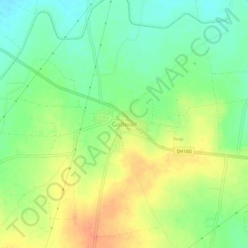
Name: Gadwad topographic map, elevation, terrain.

Location: Gadwad, Latur, Maharashtra, India (18.49665 76.31254 18.53665 76.35254)

Average elevation: 639 m

Minimum elevation: 619 m

Maximum elevation: 662 m

Gear up for your next adventure:

🛁Quick-Dry Microfiber Towel - Space-saving towel that dries rapidly on the move
🧥Thermal Layer - Insulating layer for cold outdoor conditions
🥾Durable Hiking Shoes - Long-lasting shoes for frequent hiking
🚲MTB Frame Bag - Carry tools and maps directly on your bicycle frame
🧢Hiking Hat - Sun-protective and breathable hats for long treks

As an Amazon Associate, this site earns from qualifying purchases at no extra cost to you.