
Make a donation
Gear up for your next adventure:
As an Amazon Associate, this site earns from qualifying purchases at no extra cost to you.
Yellandu topographic map
Click on the map to display elevation.
Make a donation
Gear up for your next adventure:
As an Amazon Associate, this site earns from qualifying purchases at no extra cost to you.
Yellandu
Yellandu is located at 17°36′N 80°20′E / 17.6°N 80.33°E / 17.6; 80.33. It has an average elevation of 205 metres (672 feet). Bhuga vagu divides Yellandu which is started from Yellandula padu cheruvu. one of the important coal seams bore his name. The Hyderabad (Deccan) Company Limited incorporated in England acquired mining rights in 1886 to exploit coal found in Yellandu area. The present Company was incorporated on 23 December 1920 under the Hyderabad Companies Act as a public limited company with the name 'The Singareni Collieries Company Limited' (SCCL). It acquired all the assets and liabilities of the Hyderabad (Deccan) Co. Ltd. Best & Co., acted as Secretaries and Selling Agents. The State of Hyderabad purchased majority shares of the Company in 1945. From 1945 to 1949, the Hyderabad Construction Co., Ltd., was acting as Managing Agent. In 1949 this function was entrusted to Industrial Trust Fund by the then Government of Hyderabad. The controlling interest of the Company devolved on the Government of Andhra Pradesh in 1956 pursuant to the reorganization of States.
Make a donation
Gear up for your next adventure:
As an Amazon Associate, this site earns from qualifying purchases at no extra cost to you.
About this map
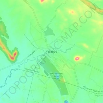
Name: Yellandu topographic map, elevation, terrain.
Average elevation: 225 m
Minimum elevation: 169 m
Maximum elevation: 377 m
Make a donation
Gear up for your next adventure:
As an Amazon Associate, this site earns from qualifying purchases at no extra cost to you.