Geolocate

Zappa topographic map

Click on the map to display elevation.

About this map

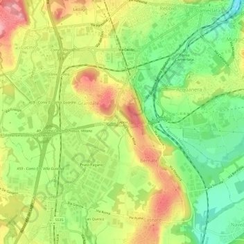
Name: Zappa topographic map, elevation, terrain.

Location: Zappa, Grandate, Como, Lombardy, 22073, Italy (45.75206 9.04578 45.79206 9.08578)

Average elevation: 305 m

Minimum elevation: 244 m

Maximum elevation: 373 m

Gear up for your next adventure:

🧦Outdoor Socks - Durable socks designed for hiking and outdoor sports
🧭Orienteering Kit - Tools for map reading and navigation in the wild
🧦Crew Hiking Socks - Comfortable socks for long-distance hikes
🧤Thermal Hiking Gloves - Grip-enhanced gloves for cold-weather altitude trekking
Camping Groundsheet - Protect your tent from moisture and dirt

As an Amazon Associate, this site earns from qualifying purchases at no extra cost to you.