
La Pampa topographic map
Interactive map
Click on the map to display elevation.
About this map
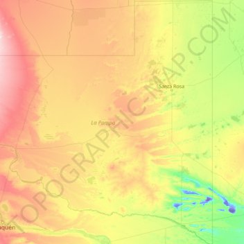
Name: La Pampa topographic map, elevation, terrain.
Location: La Pampa, Argentinien (-39.33065 -68.29677 -35.00226 -63.38319)
Average elevation: 262 m
Minimum elevation: -45 m
Maximum elevation: 1,131 m