
Thank you for supporting this site ❤️
Make a donation
Make a donation
Gear up for your next adventure:
As an Amazon Associate, this site earns from qualifying purchases at no extra cost to you.
Villanova topographic map
Click on the map to display elevation.
Thank you for supporting this site ❤️
Make a donation
Make a donation
Gear up for your next adventure:
As an Amazon Associate, this site earns from qualifying purchases at no extra cost to you.
About this map
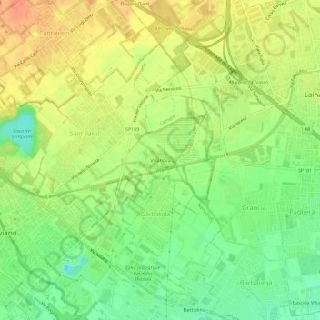
Name: Villanova topographic map, elevation, terrain.
Location: Villanova, Garbatola, Nerviano, Milano, Lombardia, 20014, Italia (45.54271 8.97915 45.58271 9.01915)
Average elevation: 179 m
Minimum elevation: 154 m
Maximum elevation: 203 m
Thank you for supporting this site ❤️
Make a donation
Make a donation
Gear up for your next adventure:
As an Amazon Associate, this site earns from qualifying purchases at no extra cost to you.