
Frahan topographic map
Interactive map
Click on the map to display elevation.
About this map
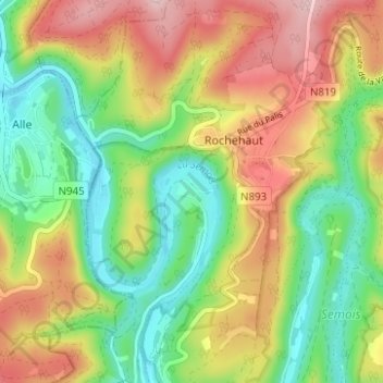
Name: Frahan topographic map, elevation, terrain.
Location: Frahan, Luxemburg, Wallonië, België (49.81509 4.98011 49.85509 5.02011)
Average elevation: 291 m
Minimum elevation: 184 m
Maximum elevation: 431 m