Meyrueis topographic map
Click on the map to display elevation.
Meyrueis
The town of Meyrueis is located between the foothills of Mont Aigoual to the south and the Causse Méjean to the north. The town thus marks the border between the geographic areas of the Grands Causses, Causse Noir and Causse Méjean, and the Cévennes Mountains. Three rivers meet there: the Jonte, the Béthuzon and the Brèze. The communal territory extends across 10,468 hectares, delimited by an approximate rectangle 25 km long and 10 km wide. It has an average altitude of 706 metres; the highest point is 1562 metres.
About this map
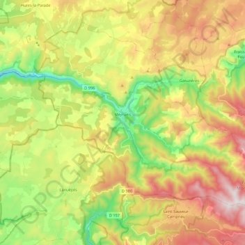
Name: Meyrueis topographic map, elevation, terrain.
Average elevation: 993 m
Minimum elevation: 591 m
Maximum elevation: 1,483 m
Other topographic maps
Click on a map to view its topography, its elevation and its terrain.