Geolocate

Karkala topographic map

Click on the map to display elevation.

Karkala

Karla is located at 13°12′N 74°59′E / 13.2°N 74.98°E / 13.2; 74.98. It has an average elevation of 81 metres (265 feet).

Wikipedia (CC-BY-SA 3.0)

About this map

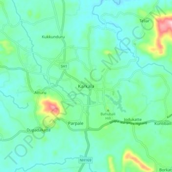
Name: Karkala topographic map, elevation, terrain.

Location: Karkala, Karkala taluk, Udupi, Karnataka, 574104, India (13.17454 74.95519 13.25454 75.03519)

Average elevation: 80 m

Minimum elevation: 38 m

Maximum elevation: 242 m

Gear up for your next adventure:

💡Portable Camping Lamp - Rechargeable lamp for campsite lighting
🧥Waterproof Hiking Jacket - Protect yourself from rain and wind while hiking
Lightweight Backpacking Tent - Compact tent for efficient hiking trips
👟Sport Hiking Sandals - Breathable footwear for water crossings and camp rest
🧭GPS Tracker - Track your location in remote areas safely

As an Amazon Associate, this site earns from qualifying purchases at no extra cost to you.