Geolocate

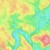
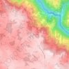
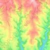
Najac topographic map

Click on the map to display elevation.

About this map

Name: Najac topographic map, elevation, terrain.

Location: Najac, Villefranche-de-Rouergue, Aveyron, Occitania, Metropolitan France, 12270, France (44.16964 1.89017 44.24757 2.02631)

Average elevation: 355 m

Minimum elevation: 142 m

Maximum elevation: 506 m

Other topographic maps

Click on a map to view its topography, its elevation and its terrain.

La Tapie

France > Occitania > Aveyron > La Salvetat-Peyralès

Average elevation: 490 m

Vanc

France > Occitania > Aveyron > Salles-la-Source

Average elevation: 509 m

Vanc

France > Occitania > Aveyron > Salles-la-Source

Average elevation: 509 m

Single

France > Occitania > Aveyron > Fondamente

Average elevation: 628 m

Calcomier

France > Occitania > Aveyron > Rodez

Average elevation: 570 m

Rouens

France > Occitania > Aveyron > Saint-Hippolyte

Average elevation: 602 m

Saint-Germain

France > Occitania > Aveyron > Millau

Average elevation: 632 m

La Bastide des Fonts

France > Occitania > Aveyron > Cornus

Average elevation: 694 m

Ceyrac

France > Occitania > Aveyron > Gabriac

Average elevation: 595 m

Issis

France > Occitania > Aveyron > Creissels

Average elevation: 540 m

Le Mauron

France > Occitania > Aveyron > Maleville

Average elevation: 451 m

Calcomier

France > Occitania > Aveyron > Rodez

Average elevation: 570 m

Cantobre

France > Occitania > Aveyron > Nant

Average elevation: 666 m

Taulan

France > Occitania > Aveyron > Roquefort-sur-Soulzon

Average elevation: 606 m

La Malette

France > Occitania > Aveyron > Entraygues-sur-Truyère

Average elevation: 410 m

Issis

France > Occitania > Aveyron > Creissels

Average elevation: 540 m

Massip

France > Occitania > Aveyron > Golinhac

Average elevation: 572 m

Leth

France > Occitania > Aveyron > Florentin-la-Capelle

Average elevation: 490 m

Le Rouve

France > Occitania > Aveyron > Salles-Curan

Average elevation: 840 m

Les Tour

France > Occitania > Aveyron > Druelle Balsac > Druelle

Average elevation: 582 m

Le Contourès

France > Occitania > Aveyron > Castanet

Average elevation: 635 m

Gear up for your next adventure:

🦯Trekking Poles - Reduced impact on joints for steep topographic climbs
⛺Camping Tent - Weather-resistant tents suitable for 2 to 6 people
🛶Kayak Accessories - Essential gear for safe and fun kayaking adventures
🧴Waterproofing Spray - Restore the DWR coating on jackets and tents
🥾Light Trekking Boots - Supportive boots for multi-day treks

As an Amazon Associate, this site earns from qualifying purchases at no extra cost to you.