Geolocate

Santaluca topographic map

Click on the map to display elevation.

About this map

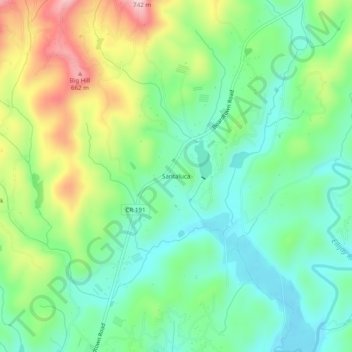
Name: Santaluca topographic map, elevation, terrain.

Location: Santaluca, Gilmer County, Georgia, United States (34.76703 -84.45465 34.80703 -84.41465)

Average elevation: 507 m

Minimum elevation: 420 m

Maximum elevation: 678 m

Gear up for your next adventure:

Tent Footprint - Protect tent floor and increase durability
Lightweight Backpacking Tent - Compact tent for efficient hiking trips
🦶Anti-Blister Balm - Prevents friction and hotspots during long ascents
🛶Waterproof Dry Bags - Keep electronics and clothes dry during river crossings
🧦Hiking Socks - Moisture-wicking and comfortable socks for long hikes

As an Amazon Associate, this site earns from qualifying purchases at no extra cost to you.