Geolocate

Jaisinghpur topographic map

Click on the map to display elevation.

About this map

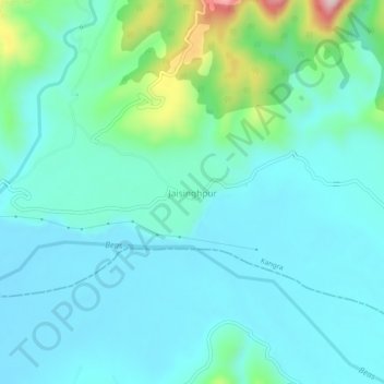
Name: Jaisinghpur topographic map, elevation, terrain.

Location: Jaisinghpur, Kangra, Himachal Pradesh, 176095, India (31.87885 76.57895 31.91885 76.61895)

Average elevation: 593 m

Minimum elevation: 535 m

Maximum elevation: 857 m

Gear up for your next adventure:

🧭GPS Tracker - Track your location in remote areas safely
🧴Insect Repellent - Protect yourself from bugs during outdoor adventures
🧰Survival Kit - Essential gear for emergencies in the wilderness
🕯️Camping Lantern - Illuminates your entire campsite with high-efficiency LEDs
🥫Freeze-Dried Meals - Lightweight, high-calorie nutrition for multi-day treks

As an Amazon Associate, this site earns from qualifying purchases at no extra cost to you.