Geolocate

Liquicia topographic map

Click on the map to display elevation.

About this map

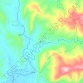
Name: Liquicia topographic map, elevation, terrain.

Location: Liquicia, Caba, La Union, Ilocos Region, Philippines (16.41697 120.38592 16.45697 120.42592)

Average elevation: 124 m

Minimum elevation: 15 m

Maximum elevation: 347 m

Gear up for your next adventure:

👟Leg Gaiters - Keep debris, mud, and snow out of your boots
🚑Survival Whistle - Signal for help across long distances in mountains
🥾Trekking Poles - Adjustable trekking poles to reduce knee stress and improve stability
❄️Traction Ice Cleats - Slip-on spikes for icy trails and winter hiking
Lightweight Camping Tent - Portable shelter optimized for Canadian backcountry camping

As an Amazon Associate, this site earns from qualifying purchases at no extra cost to you.