Geolocate

Belleville topographic map

Click on the map to display elevation.

About this map

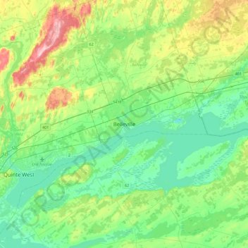
Name: Belleville topographic map, elevation, terrain.

Location: Belleville, Central Ontario, Ontario, K8N 2Z2, Canada (44.00333 -77.54526 44.32333 -77.22526)

Average elevation: 107 m

Minimum elevation: 58 m

Maximum elevation: 236 m

Belleville trails, hiking, mountain biking, running and outdoor activities

Gear up for your next adventure:

🧳Compression Sacks - Maximize space in your backpack by shrinking gear
🔦LED Headlamp - Hands-free lighting for early morning starts or late finishes
🧊Insulated Water Bottle - Keeps drinks cold in summer and prevents freezing in winter
🩹Moleskin Blister Pads - Direct protection for painful foot pressure points
🛰️Satellite Messenger - Emergency communication for areas with no cell service

As an Amazon Associate, this site earns from qualifying purchases at no extra cost to you.