Geolocate

Ratangarh topographic map

Click on the map to display elevation.

Ratangarh

Ratangarh is located at 28°05′N 74°36′E / 28.08°N 74.6°E / 28.08; 74.6. It has an average elevation of 312 metres (1023 feet).

Wikipedia (CC-BY-SA 3.0)

About this map

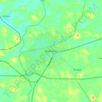
Name: Ratangarh topographic map, elevation, terrain.

Location: Ratangarh, Ratangarh Tehsil, Churu, Rajasthan, 331022, India (28.03496 74.58435 28.11496 74.66435)

Average elevation: 316 m

Minimum elevation: 301 m

Maximum elevation: 343 m

Gear up for your next adventure:

Camping Groundsheet - Protect your tent from moisture and dirt
🔋Solar Power Bank - Keep your GPS and devices charged during long outdoor trips
🥾Mountain Hiking Boots - High-traction boots for rocky terrain
🛏️Camping Sleeping Mat - Comfortable mats for sleeping outdoors
🧦Hiking Liner Socks - Thin base layer to prevent friction and blisters

As an Amazon Associate, this site earns from qualifying purchases at no extra cost to you.