Geolocate

Klampis topographic map

Click on the map to display elevation.

About this map

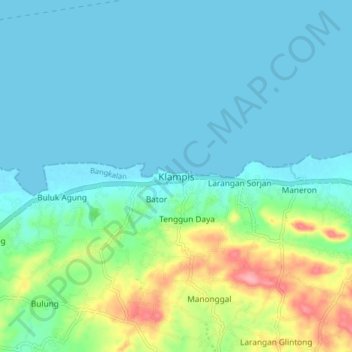
Name: Klampis topographic map, elevation, terrain.

Location: Klampis, Bangkalan, East Java, Java, Indonesia (-6.93381 112.86812 -6.85381 112.94812)

Average elevation: 22 m

Minimum elevation: -1 m

Maximum elevation: 105 m

Gear up for your next adventure:

🧥Ultralight Puffy Jacket - Maximum warmth that packs down to the size of an orange
🥾Lightweight Hiking Boots - Boots for comfort and mobility on long hikes
🥘Camping Cookware Set - Compact nesting pots and pans for trail cooking
🛶Waterproof Dry Bags - Keep electronics and clothes dry during river crossings
🎒Fully Waterproof Backpack - Total protection for photography gear and electronics

As an Amazon Associate, this site earns from qualifying purchases at no extra cost to you.