Geolocate

Churacán topographic map

Click on the map to display elevation.

About this map

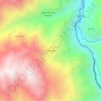
Name: Churacán topographic map, elevation, terrain.

Location: Churacán, San Rafael, Province of Ambo, Huánuco, Peru (-10.26178 -76.18910 -10.22178 -76.14910)

Average elevation: 3,103 m

Minimum elevation: 2,400 m

Maximum elevation: 3,805 m

Gear up for your next adventure:

🧣Merino Neck Gaiter - Protects against wind, sun, and cold at high altitudes
🚲Handlebar Phone Mount - View topographic-map.com live while cycling
🥽Outdoor Goggles - Protective eyewear for outdoor activities
🥾Waterproof Hiking Boots - Essential footwear for rugged terrain and wet Canadian trails
🧴Sunscreen SPF - Broad-spectrum sunscreen for outdoor activities

As an Amazon Associate, this site earns from qualifying purchases at no extra cost to you.