
Bethel topographic map
Click on the map to display elevation.
About this map
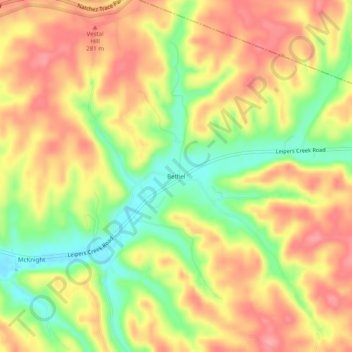
Name: Bethel topographic map, elevation, terrain.
Average elevation: 255 m
Minimum elevation: 199 m
Maximum elevation: 297 m
Other topographic maps
Click on a map to view its topography, its elevation and its terrain.
Columbia
United States > Tennessee > Maury County
According to the United States Census Bureau, the city has a total area of 29.6 square miles (77 km2), of which 29.6 square miles (77 km2) is land and 0.03% is water. Incorporated in 1817, the city is at an elevation of 637 feet (194 m).
Average elevation: 214 m