Geolocate

Loni topographic map

Click on the map to display elevation.

About this map

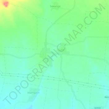
Name: Loni topographic map, elevation, terrain.

Location: Loni, Warud, Amravati, Maharashtra, India (21.35850 78.15944 21.39025 78.20953)

Average elevation: 364 m

Minimum elevation: 340 m

Maximum elevation: 427 m

Gear up for your next adventure:

🧰Emergency Multi-Tool - Compact multi-tool for outdoor survival
🧥Waterproof Pants - Keep dry during rainy hiking conditions
🥾Trekking Poles - Adjustable trekking poles to reduce knee stress and improve stability
🔦UV Flashlight - Detect minerals or specific insects in the dark
🧊Portable Cooler - Keep food and drinks cold during outdoor adventures

As an Amazon Associate, this site earns from qualifying purchases at no extra cost to you.