Geolocate

Baybay topographic map

Click on the map to display elevation.

About this map

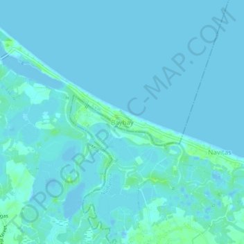
Name: Baybay topographic map, elevation, terrain.

Location: Baybay, Makato, Aklan, Western Visayas, 5604, Philippines (11.72120 122.29030 11.76120 122.33030)

Average elevation: 2 m

Minimum elevation: -4 m

Maximum elevation: 10 m

Gear up for your next adventure:

🧭GPS Tracker - Track your location in remote areas safely
🧢Sun Hat - Wide-brim hat for sun protection
🥾Hiking Shorts - Breathable shorts suitable for summer hikes
💡Compact LED Flashlight - Powerful and portable flashlight for outdoor use
💡LED Camping Lantern - Illuminate your campsite with long-lasting lanterns

As an Amazon Associate, this site earns from qualifying purchases at no extra cost to you.