Geolocate

Deoli topographic map

Click on the map to display elevation.

About this map

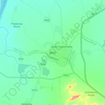
Name: Deoli topographic map, elevation, terrain.

Location: Deoli, Deoli Tehsil, Tonk District, Rajasthan, 323802, India (25.72005 75.33559 25.80005 75.41559)

Average elevation: 332 m

Minimum elevation: 305 m

Maximum elevation: 425 m

Gear up for your next adventure:

🦶Hiking Shoe Insoles - Added support for high arches and long days on feet
🕶️Polarized Sunglasses - Reduces glare from snow and water at high elevations
🛁Quick-Dry Microfiber Towel - Space-saving towel that dries rapidly on the move
🥾Hiking Shorts - Breathable shorts suitable for summer hikes
🧢Sun Protection Cap - Breathable cap to protect from sun exposure

As an Amazon Associate, this site earns from qualifying purchases at no extra cost to you.