Geolocate

Sisseln topographic map

Click on the map to display elevation.

About this map

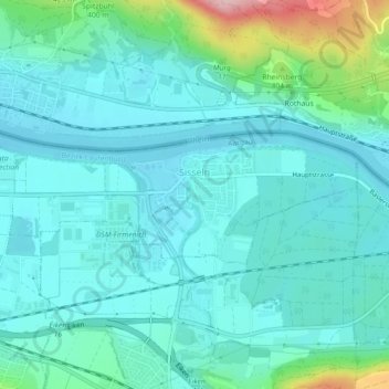
Name: Sisseln topographic map, elevation, terrain.

Location: Sisseln, Bezirk Laufenburg, Aargau, 4334, Switzerland (47.54627 7.96335 47.55714 8.00802)

Average elevation: 323 m

Minimum elevation: 287 m

Maximum elevation: 487 m

Gear up for your next adventure:

🔦LED Flashlight - Powerful and long-lasting flashlight for camping and emergencies
🛰️Satellite Messenger - Emergency communication for areas with no cell service
🧥Softshell Hiking Jacket - The perfect balance of wind protection and breathability
💧Hydration Bladder - Hands-free hydration solution for long treks
🧤Insulated Winter Gloves - Heavy-duty protection for sub-zero Canadian adventures

As an Amazon Associate, this site earns from qualifying purchases at no extra cost to you.