Geolocate

Nivin topographic map

Click on the map to display elevation.

About this map

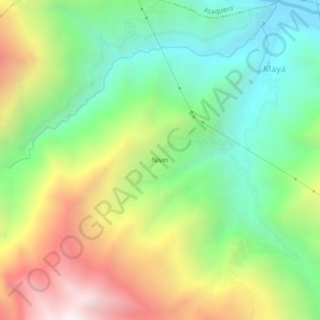
Name: Nivin topographic map, elevation, terrain.

Location: Nivin, Carhuaz, Áncash, 02127, Perú (-9.31548 -77.71072 -9.27548 -77.67072)

Average elevation: 3,211 m

Minimum elevation: 2,563 m

Maximum elevation: 4,214 m

Gear up for your next adventure:

🧢Outdoor Visor - Breathable visor for sunny hikes
🥾Hiking Boots - Sturdy boots providing ankle support and traction on rugged trails
🧥Waterproof Pants - Keep dry during rainy hiking conditions
🧦Hiking Liner Socks - Thin base layer to prevent friction and blisters
🚲MTB Frame Bag - Carry tools and maps directly on your bicycle frame

As an Amazon Associate, this site earns from qualifying purchases at no extra cost to you.