Geolocate

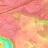
Orgeval topographic map

Click on the map to display elevation.

About this map

Name: Orgeval topographic map, elevation, terrain.

Location: Orgeval, Saint-Germain-en-Laye, Yvelines, Ile-de-France, Metropolitan France, 78630, France (48.89165 1.93069 48.94567 2.00894)

Average elevation: 128 m

Minimum elevation: 17 m

Maximum elevation: 190 m

Other topographic maps

Click on a map to view its topography, its elevation and its terrain.

Rodon

France > Ile-de-France > Yvelines

Average elevation: 167 m

Hautvilliers

France > Ile-de-France > Yvelines > Chevreuse

Average elevation: 127 m

La Corse

France > Ile-de-France > Yvelines > Élancourt

Average elevation: 165 m

Gear up for your next adventure:

🧢Outdoor Visor - Breathable visor for sunny hikes
👟Sport Hiking Sandals - Breathable footwear for water crossings and camp rest
🚲Heavy Duty Bike Lock - Secure your bike at the trailhead or during stops
🥤Collapsible Travel Cup - Saves space and weight in your mess kit
⛺Camping Tent - Weather-resistant tents suitable for 2 to 6 people

As an Amazon Associate, this site earns from qualifying purchases at no extra cost to you.