Geolocate

Sibutad topographic map

Click on the map to display elevation.

About this map

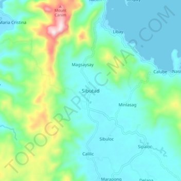
Name: Sibutad topographic map, elevation, terrain.

Location: Sibutad, Zamboanga del Norte, Zamboanga Peninsula, Philippines (8.57269 123.44018 8.65269 123.52018)

Average elevation: 124 m

Minimum elevation: 0 m

Maximum elevation: 575 m

Other topographic maps

Click on a map to view its topography, its elevation and its terrain.

Sibuco

Philippines > Zamboanga del Norte

Average elevation: 177 m

Dapitan River

Philippines > Zamboanga del Norte

Average elevation: 293 m

Sibuco

Philippines > Zamboanga del Norte

Average elevation: 177 m

Sibuco

Philippines > Zamboanga del Norte

Average elevation: 177 m

Sibuco

Philippines > Zamboanga del Norte

Average elevation: 177 m

Gear up for your next adventure:

🔋Lithium AA Batteries - Long-lasting power that performs in extreme cold
🧭GPS Handheld Device - Reliable GPS navigation for outdoor adventures
🛶Kayak Accessories - Essential gear for safe and fun kayaking adventures
🧰Survival Kit - Essential gear for emergencies in the wilderness
🧥Ultralight Puffy Jacket - Maximum warmth that packs down to the size of an orange

As an Amazon Associate, this site earns from qualifying purchases at no extra cost to you.